Wednesday 31 July 2013

Seismometer deployment to monitor drilling at Balcombe


If you follow me on twitter as well as reading my blog will know that I go by the name @TheFracDoctor. This choice of name was influenced in part by the fact that I had recently finished my PhD, and as anyone who has experienced the flush of post-viva success, there is the temptation to put the word ‘Doctor’ in front of everything. 

But also it is the role of the doctor to monitor the health of his patient, and that is how I see seismic and micro-seismic monitoring – a tool to monitor the health of a fracture stimulation.

In the last few weeks I’ve had the opportunity to do this for real in the UK for the first time: deploying seismometers around Cuadrilla’s planned Balcombe well. I’ll note right now that the current Cuadrilla plan is to drill into limestone for conventional oil, with no intention of hydraulic fracturing at this stage, but we wanted to get some experience deploying seismometers for this sort of situation.

However, Balcombe is the site of the now-infamous ‘Battle of Balcombe’ and has been at the center of much debate of unconventional gas extraction (these stations were put in a month ago, well before the events of last week). Of particular focus has been the risk of seismic activity to the Balcombe Viaduct.

This spectacular bridge, built in 1841, still carries the main London-to-Brighton rail line:


After the seismic events during stimulation at the Preese Hall well, Blackpool, concerns were raised about the possibility of similar seismic activity affecting this bridge. So we decided to deploy seismometers while they drill their Balcombe well. There are no plans for fracking at the moment, so we’re not expecting any seismic activity. Our main aims were (1) to get some experience deploying seismic stations in rural England, and (2) to record baseline activity prior to drilling.

Baseline data will help us understand the noise levels in the area, which will determine the size of the smallest earthquake we can detect – obviously the lower the noise level, the smaller event you can detect. The current traffic light scheme for seismicity proposed by DECC requires events as small as M0.0 to be detected. We want to see if this will be possible with a small array of 4 surface seismometers (we will compute the expected shaking from an M0.0 event, and see if it emerges above the noise).

Baseline data will also enable to see what changes (if any) drilling activities produce.

I will post updates as and when we collect and analyse the data. For now, this seems like a good time to share some holiday snaps, so you get to learn about what we do when we deploy seismometer arrays, and what they look like.

Firstly, here’s the piece of kit that we use: a Trillium 120 seismometer:


This is a fairly standard piece of kit in earthquake seismology, capable of measuring the vibration of the earth across a wide frequency, from long periods (up to 60 seconds) up to the sampling rate of 250Hz.

To reduce the noise from things like wind and rain, they need to be buried 50cm or so under ground. Which means you have to dig a hole. I used to work on building sites during my A-levels, and I was delighted when I got my degree, knowing that my days of manual labour were over (because digging holes all day is TOUGH work). Yet, a masters degree and PhD later, and here I am digging holes all day!


Once the pit is ready, the seismometer is carefully placed into the hole:


The batteries and data logger go in the steel box next to the pit. We run cables, insulated inside fire hose, from the instrument into the box:


Initial covering for the instrument, to further minimise surface noise, is provided by its ‘lid’, the black dome you can see below:


Once we are happy that the instrument is working properly, we fill the hole (being careful not to dislodge the insulating cover from the instrument. We lay a waterproof sheet just below the surface, and pile turf on top as a final covering:


Finally, we put a small chicken-wire fence around the station. This is more of a deterrent than anything else: it’s not likely to stop a marauding cow, nor is it really capable of keeping out a determined rodent (animals chewing on loose cables is a real problem in many seismic deployments):


And after all that (a couple of hours work at least), you have your seismic station:


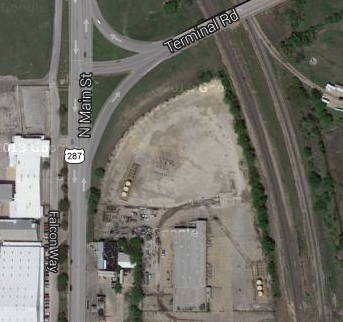
We placed 4 stations in total, including one a few hundred yards from the viaduct:


As we set this station up, we could see the vibrations from the trains going past every 5 minutes recorded on our seismometer. It will be interesting to see what caused more vibration – the Preese Hall earthquakes or the train going past at a distance of a couple of hundred yards. After all, the initial concern at Balcombe was that seismicity would trouble the bridge – even though this is a bridge that is being shaken by an express train every 5 minutes.

We enjoyed our two days in the picturesque British countryside, and we were very glad we missed all the protestors. Fortunately, the stations are all a couple of km at least from the London Road protest site, and accessible from other roads, so that’s a gauntlet we won’t have to run. The only disturbance we saw was from these guys:


So there’s our seismic deployment in Balcombe. More to follow once we’ve analysed the data.


Saturday 27 July 2013

More studies on groundwater methane in Pennsylvania - no correlation with gas wells

Warning: High concentrations of methane in water wells, well enclosures and other confined spaces can cause explosions!

Here's a fact sheet from the Pennsylvania Dept of Environmental Protection providing information about how to deal with methane in your water well (it needs to be vented so that dangerous accumulations do not build up).

Have the DEP been forced to release this emergency information in response to increases in methane contamination as shale gas drilling spreads across the land?

No, in fact if you look closely in the bottom right corner, you can see that this information sheet was published in January 2004: long before shale gas came to Pennsylvania. This provides further demonstration of elevated methane in groundwater was common prior to drilling, as has already been indicated in baseline studies.

Why does this matter? Well, in a previous post I discussed the recent Duke findings of elevated methane in water near to gas wells in Pennsylvania, and I suggested that the very non-random way in which wells were chosen for sampling may well affect some of their conclusions. I suggested that to test their conclusions, more uniform and comprehensive sampling would be required.

Well, in a recent paper published in Groundwater, we have some new data. Molofsky et al tested 1701 samples (as opposed to only 141 tested by the Duke team). The two pictures below show the sampling from Molofsky (above) and the Duke paper (below), I leave it to you to judge which provides the more comprehensive sampling:


Of the 1701 samples tested by Molofsky, 322 were within 1km of a gas well, while 1379 are characterised as being 'pre-drill' - that is no gas well within 1km at the time of sampling, taken as part of a baseline surveys conducted by the DEP.

Molofsky et al found that 78% of sampled wells had detectable methane concentrations (hence the need for the DEP's fact sheet above), and 3.4% had levels exceeding the DEP's minimum level of 7mg/L.

The size of the circles in the Molofsky figure represent the amount of methane found in groundwater. They've helpfully plotted topography in their figure - even without the help of statistics you can see a correlation with being in a valley and having elevated methane (although the stats bear this correlation out), and upland areas with low methane. Why would being in a valley lead to elevated concentrations of naturally occurring methane? Well, a picture (from a Molofsky presentation I found online) tells a thousand words:

What about correlations between methane and natural gas wells, as found by the Duke study? Well, with 10 times as many data points, Molofsky et al find zero correlation between methane and natural gas wells. As their subsection title puts it: 'No Regional Association of Methane with Gas Production'.


Oppostion to shale gas - based on science?

Is opposition to shale gas development based on science, or is it simply about scaring local residents? Here's the latest video from Frack-Off. You decide:


Credit to www.shalegas-europe.eu for finding this little beauty. You can go to their link to see some actual scientists (mainly from the BGS) talking about shale gas.

Monday 22 July 2013

Spot the Well Pads in Dallas-Fort Worth

A few weeks ago, Boris Johnson suggested bringing shale gas drilling to the outskirts of London. Surely this area is far too overpopulated to have space for such activity? Perhaps not, if the experience of Dallas-Fort Worth is anything to go by, as I mentioned during a recent radio interview.

So, lets take a look at a shale gas drilling site in Fort Worth. Here's a portion from the air:
The runways you can see are those of Fort Worth Meacham International Airport. Can you see the shale gas well site? You've probably missed it, so I've circled the most obvious evidence - two rows of yellow tanks:
Lets zoom in for a closer look:
You can see the tanks more clearly now, although the well-heads themselves are harder to see. Slightly frustratingly, when you try to zoom in on Google maps, the view changes to an earlier photo, but this is actually a good thing because you can see the wells under construction: many containers of equipment around the edge of the pad, and only a couple of well-heads placed:
You can also go to StreetView to see the site up close and personal:

You can see the 9 well heads, with 'Christmas Trees' on top of them, and the tanks to one side. These tanks are likely collecting produced water coming up with the gas. You can see that there is no need for the big, open ponds for wastewater that have been blamed for causing problems in Pennsylvania (and which are illegal in the UK).

So, how much is this single pad worth? It has 9 wells. The average total production for US shale gas wells is currently something like 3 bcf (billion cubic feet) over their lifetime, so this pad is likely to produce 27 bcf. 1 bcf contains approximately 1 million MMBTU, so 27 bcf is 27 million MMBTU. The current US gas price is approximately $4 per MMBTU, so the total gas coming from this single pad will be worth over $100 million. In the UK, gas prices are currently more like £8 per MMBTU, so a similar pad in the UK might produce a volume of gas worth £200 million.

I'll admit to being a bit of a Google Maps/Earth geek, but it really is worth checking it out, so that you can explore the site for yourself from all the angles that StreetView provides. Here's the link, go and have an explore. And you can ask yourself, knowing the value of a single such well site to the UK economy might be over £200 million, can I, or can I not, accept their development in the UK? Personally, I struggle to think of many alternatives that can give as much buck for such a small footprint.


Wednesday 10 July 2013

Breaking news: Geomechanical effects crucial for secure CO2 storage, experts warn!

Breaking news: Geomechanical effects crucial for secure CO2 storage, experts warn!

My paper, published this week in the Proceedings of the National Academy of Science, compares the geomechanical response to CO2 injection at 3 commercial-scale CO2 injection operations. This is the first time (after about 20 papers), that one of my publications has received press attention of any kind (so thanks very much to the good folks at PNAS for their work in putting together a press release).

Since this seems to be generating a modicum of interest, I thought I'd better run through a quick layman's summary of what we've found (also, I'm nervous about how the paper will be written up by non-specialist journalists, so this blog affords my a chance to put myself across in my own words).

The term 'carbon capture and storage' covers the whole process by which CO2 is captured at fossil fuel power stations, and rather than being emitted to the atmosphere where it will contribute to global warming, it is compressed and pumped to geologically-suitable places where it can be injected into deep rock formations, where it is trapped by overlying impermeable layers and permanently trapped. As an Earth Scientist, my particular focus is on the last, 'storage', phase of this process - ensuring that the injected CO2 stays buried in the ground.

The key is the aforementioned 'impermeable caprock'. Even if we start with the assumption that site operators have chosen a formation with a suitable caprock, the concern is that pressure increases caused by CO2 injection will begin to fracture the rock, ultimately creating enough fractures running through the caprock that the CO2 can escape. Such 'geomechanical' effects have been the focus of previous papers that are critical of CCS, most notably last year's Zoback and Gorelick paper.

In my paper we make observations of geomechanical deformation at 3 large-scale CCS sites: Sleipner, in the North Sea, Weyburn in Central Canada, and In Salah, Algeria. I say 'we' because I am hugely indebted to my co-authors from the BGS, from the GSC, and from BP, who helped to compile this comparison paper.

We found that the 3 sites exhibited substantially different behaviours. At Sleipner, the target formation is huge (it extends under much of the North Sea) and has excellent permeability, meaning that it soaks up CO2 like a spunge. As a result, there has been almost no pressure increase. As such, there is little risk posed by geomechanical deformation

At Weyburn, the field has experienced a long history of stress change from 50 years of oil production prior to CO2 injection. Geomechanical effects at Weyburn have been monitored using microseismic: geophones placed near to the reservoir that pick up the 'pops' and 'crackles' as the rock fractures. A total of ~100 events have been detected over 6 years, a very low amount. These are all located around the reservoir, suggesting little possibility of leakage. They were in fact mainly located around the production wells, an initially counterintuitive observation that can be explained by the long and complicated stress history of the reservoir.

In Salah has been the most geomechanically active of the 3 sites we looked at: over 1000 microseismic events were detected in only a few months. Deformation at In Salah was initially detected using satellite methods that picked up the fact that the ground surface had been uplifted by a few centimeters because of the pressure increase in the reservoir. The flow properties at In Salah are not great, (only 10 millidarcy or so),so injection has lead to substantial pressure increases, hence the surface uplift and the microseismic activity. We believe that the fracture at In Salah has extended 100-200m into the caprock. At In Salah the caprock is ~1km thick, so it's not posing a risk to storage security at this point, but it's an important lesson for future storage sites that might only have 100-200m of caprock.

Our key finding is the huge differences in geomechanical response at the different sites. This shows the importance of carrying out detailed geomechanical appraisal prior to injection at every future CCS site, and putting monitoring programs in place during injection to ensure that adverse geomechanical effects are not posing a risk to secure storage.

I'll finish with my thoughts on CCS more generally. Many people love to declare that CCS is an 'untested' technology, which, frankly, is rubbish. Statoil have been storing CO2 at Sleipner since  1995. EnCana have been storing CO2 at Weyburn since 2000. We know that it is technically feasible to store millions of tonnes of CO2 in the subsurface.

However, the problem is one of scale - it's a similar problem to that facing renewables - burning hydrocarbons with unabated emissions is so very good and providing a huge amount of energy for not very much cost, and no other method can really compete with this as yet. We know we can stick a wind turbine on top of a hill and it will generate electricity. But, as we saw in a previous post, you have to plaster a hole mountainside with them to generate as much energy over 20 years as you can get from a single shale gas well pad.

So it is with CCS: we know that we can put a million tonnes under the North Sea without too much  difficulty. But we need to be storing billions of tonnes every year to make a difference with respect to climate change. And if we are to do that, we may not have the option of being too fussy about where we store it. Given this, it seems inevitable that at some point a future CCS site will run into geomechanical difficulties. We should be prepared for this eventuality.
       

Thursday 4 July 2013

On the radio again...

Boris Johnson has called for drilling companies to leave 'no stone unfracked' in their quest for shale gas, even if it means drilling under London (paywalled link).

Here's your favourite applied geophysicist talking to BBC Radio London about his comments:


At first glance, drilling in London seems a little crazy - surely there's not enough space! However, when you look across at the US, there is drilling in close proximity to large cities, most notably in and around Dallas-Fort Worth, where there are, for example, well pads within Dallas Airport, and on the University Campus. It is common practice to tuck these sites away in industrial estates, and to build pre-fab mock-buildings around the pad so that it cannot be seen. 

However, I suspect that it will be a while before shale gas drilling ever comes to London. Firstly, it's not clear whether there's any gas under London to exploit - companies are at present looking further to the south, in places like Balcombe. The BGS will be releasing a report covering the south of England next year, so we will have to wait until then to know for sure whether there's anything under London.

Moreover, even if there is economically recoverable shale gas under London, I think it will be a while before anyone moves to try to extract it. Although drilling in urban areas is possible, it is more expensive and challenging than drilling in relatively empty countryside. Moreover, we've already seen that there are huge volumes of shale gas to the north. I suspect that companies will be focusing their energies on the Bowland for the coming years - this will be the formation that determines whether UK shale gas succeeds or fails.